Resultats de la cerca
Es mostren 5 resultats
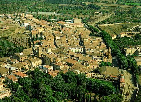
Montbrió del Camp
Montbrió del Camp
© Fototeca.cat
Municipi
Municipi del Baix Camp.
Situació i presentació S’estén entre les rieres de Riudecanyes, que el separa de Mont-roig del Camp W, i d’Alforja, que, encara que per dintre el terme de Montbrió, passa molt a prop de la partió amb Vinyols i els Arcs, i Riudoms E El terme limita, a més, amb Riudecanyes NW, Botarell N i Cambrils S L’altitud del terme oscilla entre els 100 i els 160 m per tant, es tracta d’una planura amb molt pocs trencats És travessat, a més, pel barranc de les Esclotes o de Segura i pel Torrent, dit abans d’entrar al municipi, barranc de l’Ànima Blanca L’únic nucli de població i cap de municipi és la vila…
Arbolí
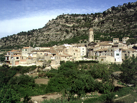
Arbolí (Baix Camp)
© Fototeca.cat
Municipi
Municipi del Baix Camp.
Situació i presentació Limita amb els termes d’Alforja S, Vilaplana E i la Febró NE, tots tres del Baix Camp, i amb el de Cornudella de Montsant NW i W, del Priorat El cim dit el Molló o el Mirador 915 m és a l’extrem sud-occidental del terme i forma un quadrifini entre Arbolí, Cornudella, Porrera i Alforja El municipi és al sector sud-oest de les Muntanyes de Prades, que aquí sobrepassen els 1000 m al puig de Gallicant 1009 m i donen al territori un caràcter molt trencat i accidentat Una bona part del terme pertany d’una manera molt clara i plenament admesa al Baix Camp, raó per la qual el…
Castellvell del Camp
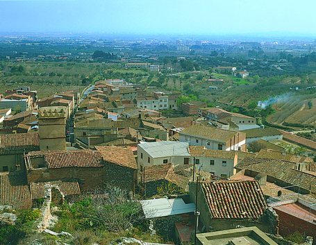
Castellvell del Camp
© Fototeca.cat
Municipi
Municipi del Baix Camp.
Situació i presentació El terme de Castellvell, de forma triangular, és encerclat pels d’Almoster E, l’Aleixar W i Reus S És situat a la plana del Camp, sota els primers estreps de les Muntanyes de Prades El punt més alt del terme és el Salvià de Lluardo, que assoleix els 473 m d’altitud, mentre que els punts més baixos són a uns 160 m El punt més conegut a la rodalia és el puig de l’Àliga o muntanya del Pal, de 302 m El terme, travessat només pel barranc de Roquís, és pobre en aigües, per bé que la construcció d’un canal del pantà de Riudecanyes ha millorat molt la situació, alhora que s’han…
Tremp
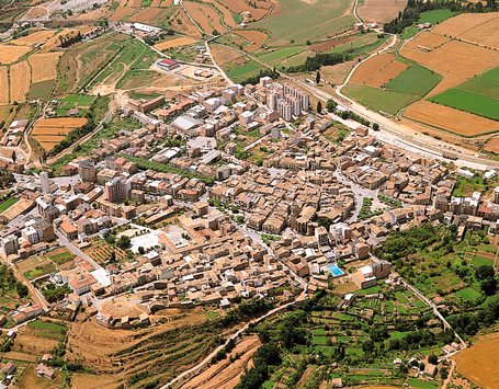
Vista aèria de Tremp
© Fototeca.cat
Municipi
Municipi i cap de la comarca del Pallars Jussà, al centre de la conca de Tremp.
Situació i presentació El municipi de Tremp és un dels exemples més complexos de la geografia de Catalunya, per tal com té 302,82 km 2 , sense continuïtat física i amb gairebé una trentena d’entitats de població Aquests fets comporten que l’estudi d’aquest municipi no sigui moltes vegades unitari pel que fa a la descripció La superfície del municipi de Tremp ha canviat al llarg dels anys Tremp tenia un terme històric de 8,3 km 2 , que comprenia la ciutat de Tremp i la quadra de Claret, que formava tradicionalment un enclavament separat pel municipi de Talarn Des de 1840 Tremp passà a ser…
Catalunya
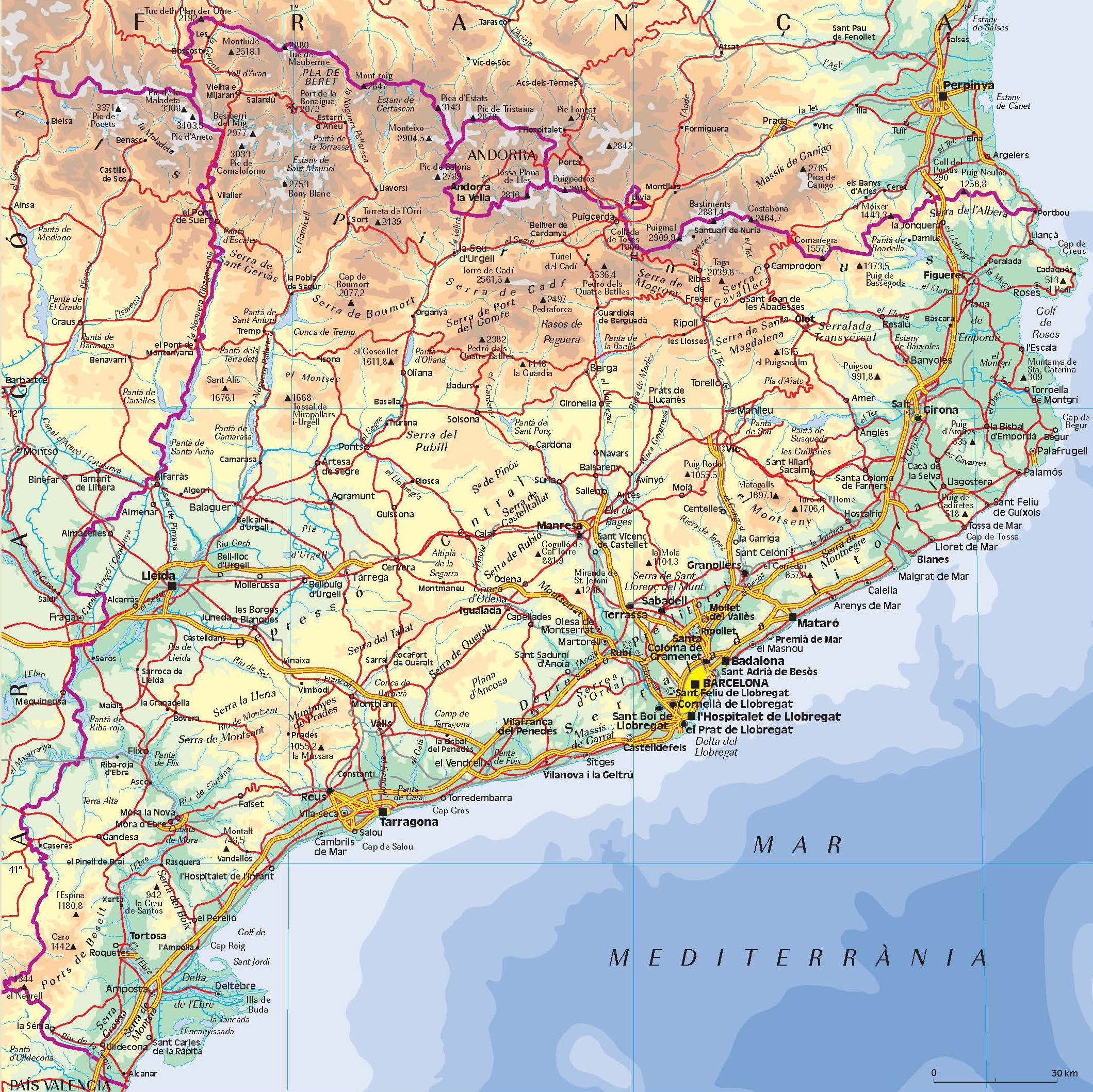
País
País de l’Europa mediterrània, a la costa oriental de la península Ibèrica; la capital és Barcelona.
Abast, origen i derivacions de la denominació Constitueix la part territorialment més extensa de l’anomenat Principat de Catalunya i inclou el nucli originari de tot el conjunt de terres de parla i cultura catalanes, els Països Catalans, dels quals és també el més extens El primer nucli territorial al qual s’aplicà després el nom de Catalunya es constituí a la fi del segle X com a conjunt de comtats de l’imperi franc al voltant del de Barcelona Marca Hispànica A mitjan segle XI, el nucli format pels territoris dels comtes d’Urgell, Besalú, Cerdanya i Barcelona, anomenat pels països…